A confusing synoptic setup gives way to a great first chase of the season. Chased with Cj Sayre, Tyler Snider, and Ben Davis into the Hill Country of Texas southeast of Abilene and managed to capture the best storm of the day after abandoning crapvection further east near our initial target of Comanche. Also got a chance to meet one of the panhandle guys, Brandon Green.
This day began showing up way out into GFS fantasy land and was bounced around anywhere from Friday to the next Tuesday. After a winter of a horrible flow regime, with stout east coast troughing leading to frequent polar intrusions, I was itching to get back out. Finally, the day got within mid-range model guidance and an interesting scenario took hold. A somewhat diffuse dryline was progged to set up just east of the Hill Country along US 281 and drift east during the early evening with possible supercellular storms firing as it neared the 35 corridor. Thankfully the setup looked assured to land on Saturday the 15th which was the first day of my spring break.
The morning of, a broad positively-tiled trough was sitting squarely over AZ/NM and looked to move east rapidly through the day. A weakness at the 500 mb level was a contributing factor to the uncertainty going into this setup as well as veered 850s and weak low-level flow.

Vissat also showed a very thick layer of stratus across much of the warm sector due to the rapid moisture return the morning of, throwing the decency of the thermodynamic environment into doubt.


The morning sounding from DFW did nothing to dispel our uneasiness with an elevated inversion and a veered low-level wind profile which did not bode well for our initial target of Stephenville 70 miles SW of Fort Worth. The SPC went with a SLGT over much of eastern Texas and a surprising 5% tornado risk for most of the SLGT. We rolled out of Norman around 7:30 and began to make our way south.
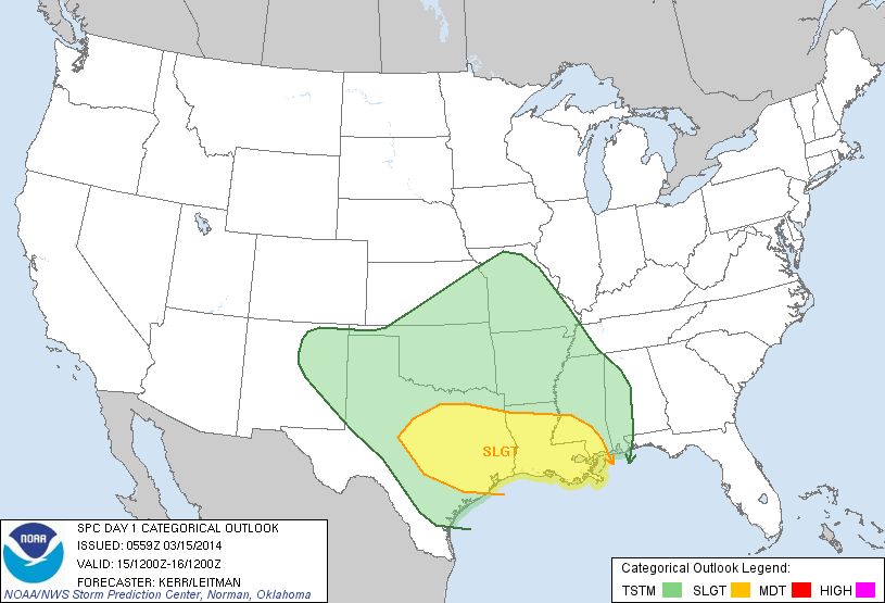
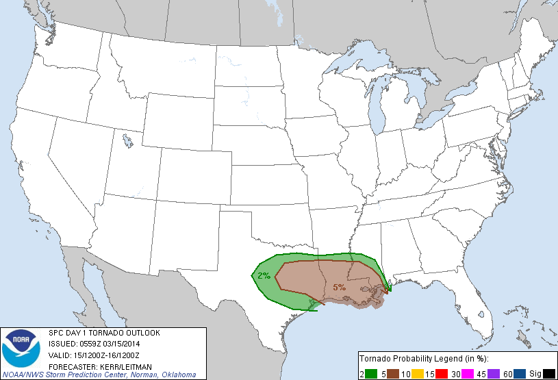
As we made our way down 35, we decided to completely avoid the construction hellhole that is Denton and continued SW towards Decatur from Gainesville on a TX highway. We were still socked in with heavy cloud cover and occasional drizzle at this point. We decided to make a stop at the McDonald's in Decatur to mooch off the free wifi and take a look at what had occurred over the past three hours since we had left. Sfc winds had continued to back out of the SE but were still extraordinarily weak and cloud cover was still persisting across much of the target area. We moved out of Decatur after an hour of sitting on our butts and made it to Stephenville around 17Z (noon) as the initial line of crappy storms went up along a moisture gradient/diffluence zone.

We stopped in the Starbucks to assess our options as storms were firing up and down the entire line. We also noted CU field way back S of Lubbock that was drifting east. After nearly smashing my computer in full view of innocent bystanders as it failed to connect to Starbucks' wifi, I called my friend Andrew and had him give me an update. The storms immediately in front of us looked like junk and the CU field to the west looked deeper and healthier. It also would be moving into an untapped environment for the next few hours. We were initially confused by the position of the dryline as the sfc obs didn't show a distinct boundary until about 40 minutes later.
After pondering our options and lots of encouragement from Andrew (I owe him a cookie), we decided to cut through the line of shit storms and go west. The next half of the chase was all Cj, he managed to get us through the spider web of backroads to I-20 around Cisco. On our way there we had the great pleasure of sitting behind this thing for roughly 15 minutes on a stretch of road where we hit about 3 towns.

We managed to get around this thing after several rage-filled attempts and continued on our way. One storm had already gone up just west of Abilene and managed to sustain itself. More storms looked immediately imminent out of that CU field.


We managed to get to Baird and gas up, before meeting with another friend from OU, just as the storm of the day got it's shit together to our immediate west. The storm quickly got it's act together to our SW as we leisurely dropped south on US 283.

The storm was crawling and we got a nice long stop just south of the county line on 283. At this point, we were all alone. Not a single chasers was on the road and it was completely silent except for the occasional grumble of thunder and wind being drawn in. The storm had a pretty rotund looking base even from a distance and a rather suspicious lowering.


We sat in this position for the next 20 minutes as the storm cycled through multiple lowering.


It finally got one really solid lowering going and had some pretty noticeable rising motion. It briefly spat out a lazily rotating funnel that none of us could confirm any ground contact on. The storm was doing great and still had a good 50 miles of untapped moisture to play in.


The storm cycled through one more beefy lowering before we decided to get a move on as rain from the FFD was beginning to fall.


We continued south and briefly attempted to move west to get closer but decided against it as terrain worsened and road options became sketchy at best. The storm had a ragged, elongated wall cloud briefly before it began to tighten up.
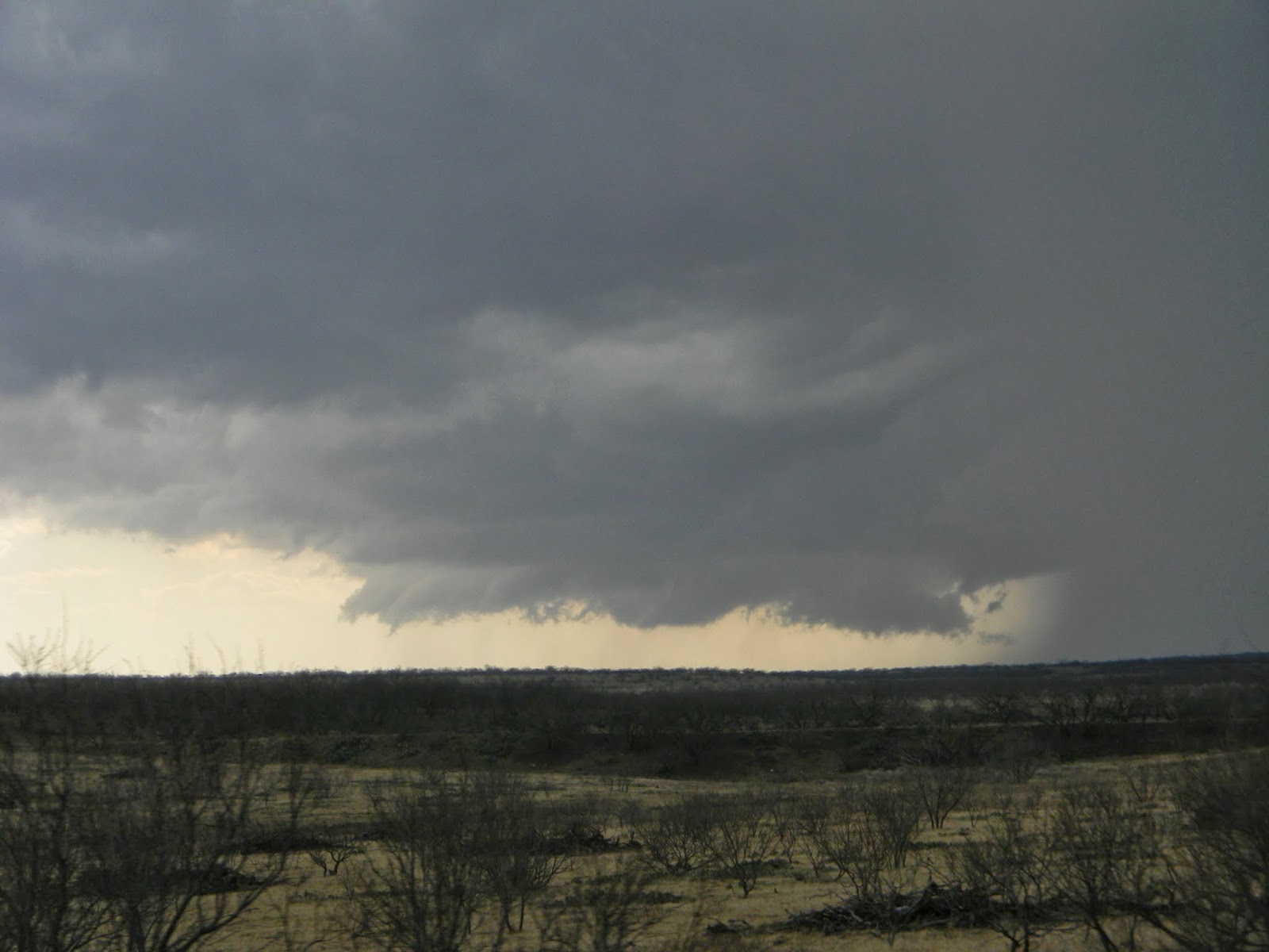
We stopped again about 12 miles north of Coleman to check out the storm and were treated to a great sight. The storm had a small little wall cloud towards the back with a turbulent updraft base and an inflow feature visible extending into the FFD.


Shortly after the last photo, we began to get rained on again and continued south towards Coleman. After one more brief stop that confirmed that the storm was gusting out, we decided to let it pass to our east before we went through Coleman and back northeast. The storm was still pretty in it's outflowy crapping of the bed.


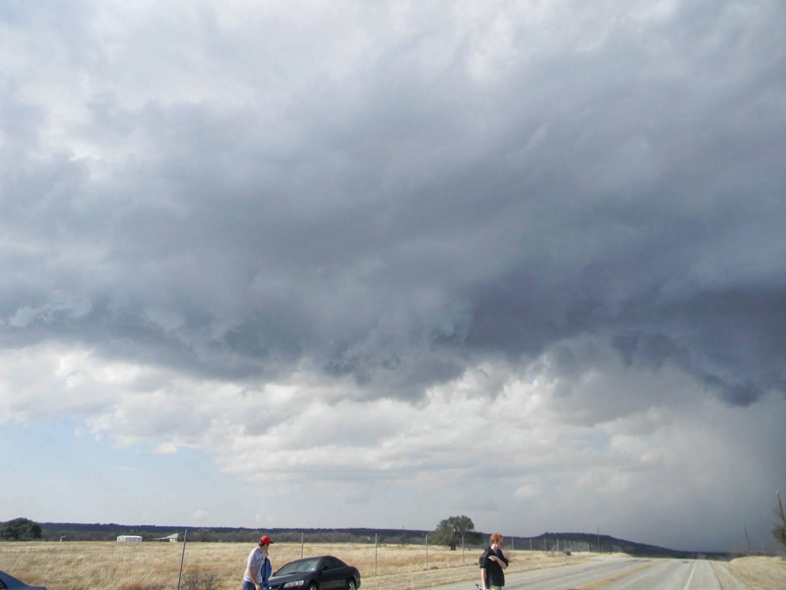


We let the storm slip east and then headed NE out of Coleman to watch the storm move away. It had a pretty looking updraft tower and even got a rainbow going at one point.


After sitting and watching it move away we continued east, while briefly stopping and checking out some the hailstones the storm had left behind. We managed to find a few golf balls mixed in (one had actually hit Tyler's trunk earlier during the second stop).


We continued north to Cisco and after grabbing a quick bite to eat at DQ, began the long trek back to Norman. Ben pointed out a fun fact on the way, that we were in fact closer to Mexico than we were Norman for most of the chase.
It was a great way to start the season and definitely has set the tone for me. Hopefully more of the same continues as we head into April. Check out below for the chase map and stats.
Side note: The Bigger Better Butter Jesus shirt seems to have good luck. His divine margarine is shining down upon me this season I guess.
Chase Stats
Miles Driven: 680.9
Cost: $32
Tornadoes: 0
Hail: 1 3/4" (golf ball)
Wind: 50 mph (estimated inflow)


