James Gustina
Summary: Chased with Andrew Lyons and Tyler Snider on a SW OK moderate risk. First tornado of the 2013 season, rain-wrapped cone that went through Lawton and did minor damage. Chased several HP supercells across SW Oklahoma but missed the best tornado coming from tail-end charlie near Vernon, Texas as the dryline shifted east in the mid-late evening. Overall a frustrating day that did not live up to the hype but I was still able to pull out some good shots of the tornadic HP near Lawton.
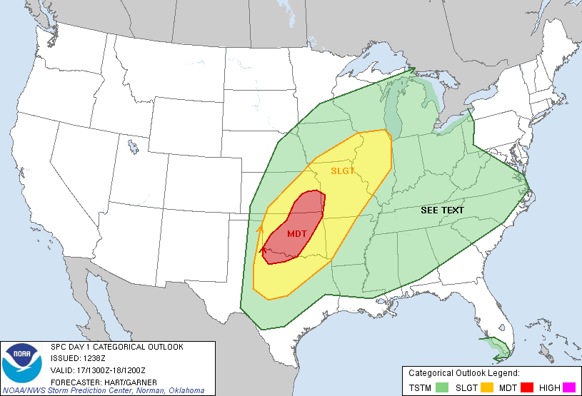
The long-range models picked up on this day pretty quickly, roughly 180 hours out. The GFS was throwing around doomsday outbreak scenarios, with the front lifting north to almost the I-70 corridor, with the dryline setting off storms in a volatile environment with CAPE values sitting at 5000 j/kg+ and deep layer shear aoa 50 kts. The Euro on the other hand took a far more conservative outlook on it, with the front lifting to about Woodward and remaining draped across northern Oklahoma until nightfall, with the triple point intersection of the dryline and the front being the focal point for development. This model uncertainty plagued the setup from the beginning and became more muddled when the NAM, WRF and SREF entered the fray. The NAM had a much more progressive front come crashing through around 00Z, potentially killing storms before the show could really get started. Unfortunately, the NAM ended up being correct, and it nailed the front position the day of exactly. The SPC threw out a MDT risk for most of central and eastern Oklahoma with a 15% hatched tornado risk.


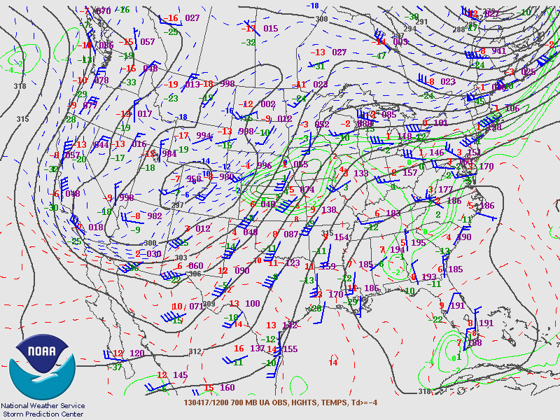
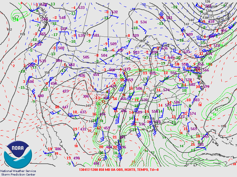
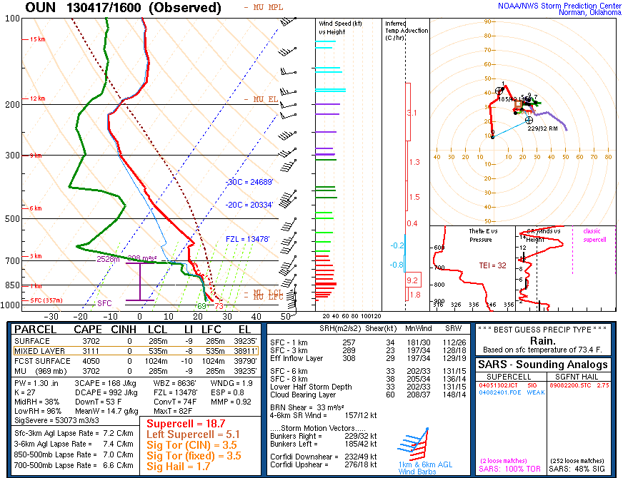
While winds the morning of looked spectacular, the positively tilted trough and distinct veering in the 700-850mb layer would ultimately end up preventing this day from realizing its potential. Still, morning soundings looked impressive and SW Oklahoma looked primed for development as the stratus deck cleared further south ahead of the front.


We got a late start to the day, not leaving until about 3:30 CDT but this ended up working out perfectly. Storms that were already ongoing near Frederick slowly got their act together and as we were within 25 minutes of Lawton, the first supercell went tornado warned. We got off at Elgin and turned south so we could meet up with another group and wait for the storm to come to us. We stopped at a gas station and observed the storm for awhile as it moved into Lawton. We also found a kitten that took to following us around the entire time we were there. The little guy even tried to get into the car when we went to leave.


Shortly after the second photo we decided to reposition to southwest of Lawton to catch the next storm bringing up the rear. The updraft continued to look healthy until we got off on SR 36 southwest of Lawton. The storm had begun to look outflow dominant, although still had a cool HP look to it with a slight green tint back in the core.


Shortly after the last photo, a radar update piqued our interest. At the time the storm was pulling in absolutely insane inflow and a couplet began to show up on radar. The tornado warning popped up right after and we bolted back to the cars and tried to get back east and north. We ran into the TWC crew on the way (they have a rather large convoy) and got a nice view of the storm on SW 82nd Street as it began to creep into Lawton. We noted a funnel down the road a ways and as it moved into Lawton saw two power flashes, one illuminating what looked like a cone funnel above it.


Even without the tornado fully visible, I decided to count this one as the first of 2013 considering we did get a brief glimpse of it, even if it wasn't what I had been hoping for. We let the supercell pass due to limited road options that would not require us to go driving through a potentially rain-wrapped updraft region and instead tried our luck on the second storm right behind it. While it looked promising for awhile, the storm got undercut and quickly died. After that we decided not to go down to the Red River after the tail-end charlie that had popped up (big mistake) and began making our way back towards Norman.


We cut north on US 81 shortly after learning about a tornado that was in progress near Elgin (right where we had been earlier) and opted to stop in Marlow and let the hail core/supercell pass, with tennis balls being reported up the road between Marlow and Rush Springs. We made it back to Norman around 10 PM and noted some flooding on Lindsey Street on the way, with one woman's car stalled out with water above her knees.
All in all, it was not what I had been expecting at all with the high promise this day had, but the lack of dryline interaction except down in Texas coupled with the rapid southward turn of the cold front by 00Z ruined this day. While I'm disappointed, it is still cool to finally get my first tornado of the 2013 season, even if it was a rain-wrapped bird fart. Hopefully 2013 kicks it into gear sometime soon!
Chase Stats
Miles Driven: 221.2
Cost: $15
Tornadoes: 1
Hail: None
Winds: 55+ (inflow)

