Thursday, January 31, 2013
Chase Season 2013 Fast Approaching
Roughly only 28 days until the unofficial start of the "chase season" and the meteorological spring starts. Today and yesterday marked the first widespread severe weather of the year as well as what is likely to be the first EF2+ tornado of 2013. Quite a few people already got their first chases of the year in over the past two days and the GFS has been hinting at the possibility of a more active pattern overspreading the CONUS some time in the distant future. I've already gone through all my stuff and besides some caked panhandle mud that needs to be washed off my tripod and some extra batteries everything is in working order and ready to go when the storms return to Tornado Alley for the 2013 season.
Tuesday, January 22, 2013
November 10 2012 Chase Log
November 10 2012
James Gustina
Summary: Fun bust in central Kansas with Zach Elliot, Cj Sayre and Andrew Lyons. Went out on the slight possibility of suprcells along the dryline but low instability and weak forcing precluded much of anything. Ended up hanging around with Ben Holcomb, Mike Boik, Dillon Killoren and a whole host of other people in Pratt to end the day.
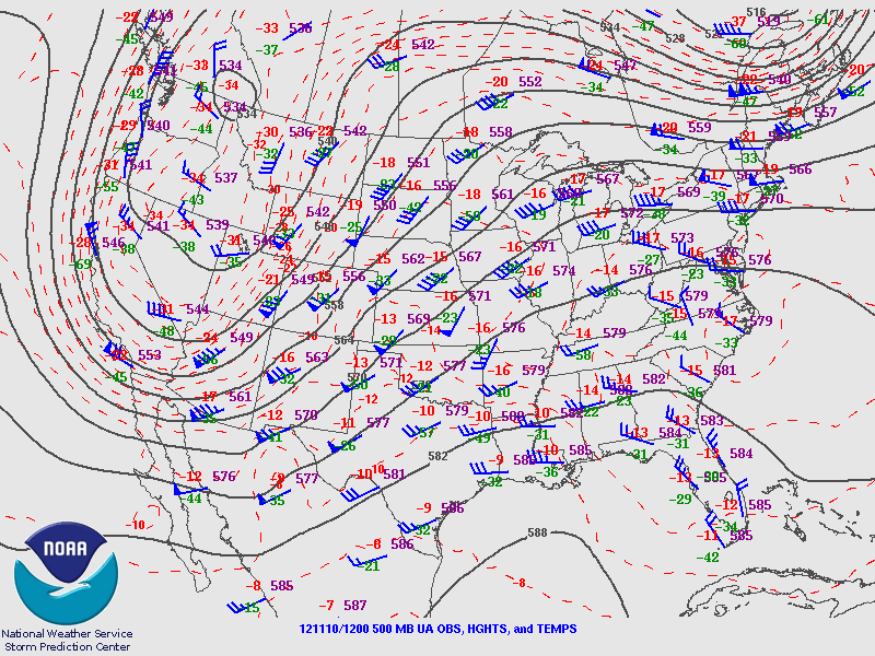
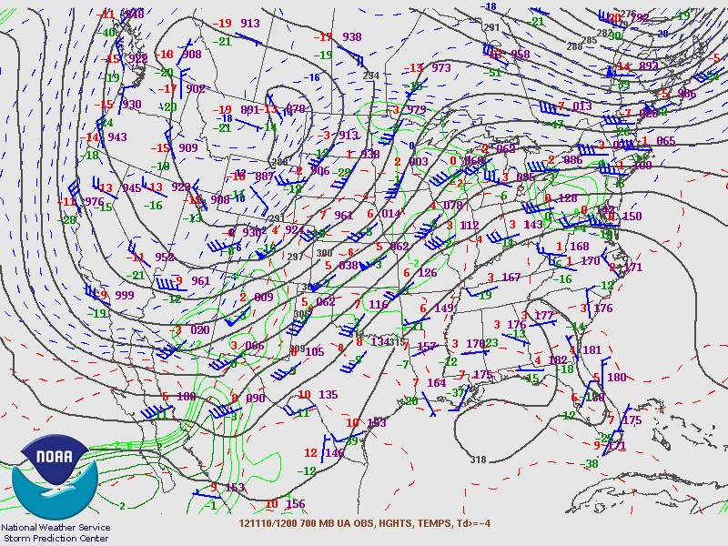
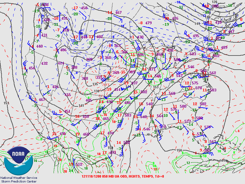
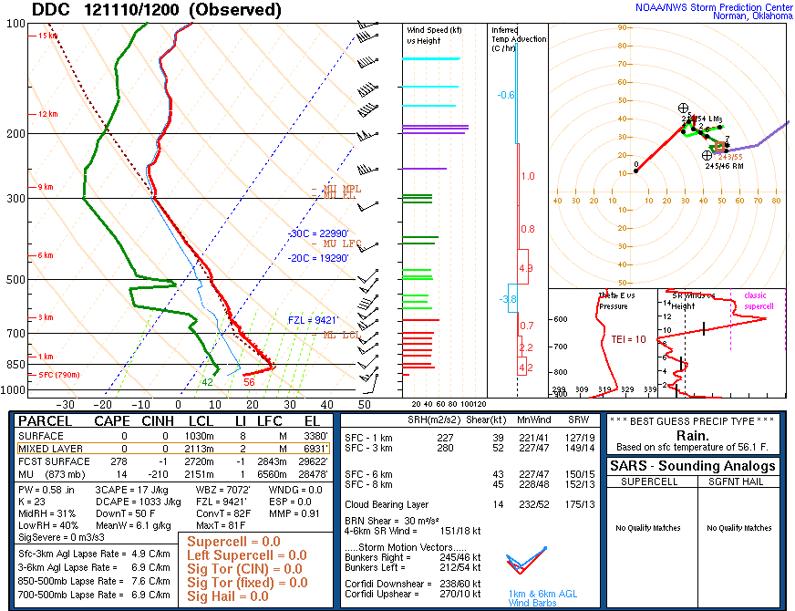
This day had potential several days out. Andrew and I had been keeping an eye on it for the past week and the night before we figured out our chase plans. A deep trough was ejecting out of the Rockies with modest instability on the order of 1500 j/kg of MLCAPE. The turning in the lowest 1 kilometer was not great but enough to get the job done had any discrete storms gone up in a more favorable environment.
The morning of we rolled out of Norman around 10 with a tentative target of Alva, OK. Around noon we stopped in Watonga for lunch at Pizza Hut. Meanwhile outside tumbleweeds the size of a child were rolling all over creation.
Side Story: Sometime between Watonga and Cherokee, we went past a farm with a single horse standing alone in the field just staring at the road. We decided to name him Eddy the Awkward Horse. Eddy wasn't like the other horses, Eddy wanted to dance. This led to a whole slew of inanimate objects with dreams to break to the tedium of driving through northwestern Oklahoma.
After lunch we decided to cut north towards Cherokee. Nothing but some very flat, uninteresting CU was present just along and ahead of the dryline. Shortly after crossing into Alfalfa County we ran into Ben Holcomb and Mike Boik. We ended up sitting for awhile just off US 281.

After about 30-45 minutes we continued on with Ben and Mike to Alva. A brief stop at the McDonald's didn't help our view of the prospects. Cumulus along the dryline continued to look thin and mushy. Nonetheless the SPC threw out an MCD around the same time.

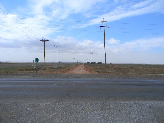
We continued north through Medicine Lodge and then through Pratt. At this point there were a few somewhat agitated towers going up. We continued north towards Great Bend, running into Dillon and a few other people on the way. Unfortunately nothing ever could quite get going. We ended up hanging around on a dirt road somewhere between Great Bend and Pratt before heading back to Pratt for dinner at Woody's.


Headed back into Pratt we noticed a large tower going up to the south. This turned out to be an LP cell that went right over where we had been earlier.
We had a fun time at Woody's, despite how it being at best, subpar. Afterwards we packed up, flashed the Dominator as it came driving through Pratt, and then were on our way back towards Wichita to cut back down onto I35 for Norman.
Chase Stats
Miles Driven: 526
Cost: $45
Tornadoes: 0
Hail: None
Winds: None
James Gustina
Summary: Fun bust in central Kansas with Zach Elliot, Cj Sayre and Andrew Lyons. Went out on the slight possibility of suprcells along the dryline but low instability and weak forcing precluded much of anything. Ended up hanging around with Ben Holcomb, Mike Boik, Dillon Killoren and a whole host of other people in Pratt to end the day.
This day had potential several days out. Andrew and I had been keeping an eye on it for the past week and the night before we figured out our chase plans. A deep trough was ejecting out of the Rockies with modest instability on the order of 1500 j/kg of MLCAPE. The turning in the lowest 1 kilometer was not great but enough to get the job done had any discrete storms gone up in a more favorable environment.
The morning of we rolled out of Norman around 10 with a tentative target of Alva, OK. Around noon we stopped in Watonga for lunch at Pizza Hut. Meanwhile outside tumbleweeds the size of a child were rolling all over creation.
Side Story: Sometime between Watonga and Cherokee, we went past a farm with a single horse standing alone in the field just staring at the road. We decided to name him Eddy the Awkward Horse. Eddy wasn't like the other horses, Eddy wanted to dance. This led to a whole slew of inanimate objects with dreams to break to the tedium of driving through northwestern Oklahoma.
After lunch we decided to cut north towards Cherokee. Nothing but some very flat, uninteresting CU was present just along and ahead of the dryline. Shortly after crossing into Alfalfa County we ran into Ben Holcomb and Mike Boik. We ended up sitting for awhile just off US 281.


After about 30-45 minutes we continued on with Ben and Mike to Alva. A brief stop at the McDonald's didn't help our view of the prospects. Cumulus along the dryline continued to look thin and mushy. Nonetheless the SPC threw out an MCD around the same time.
We continued north through Medicine Lodge and then through Pratt. At this point there were a few somewhat agitated towers going up. We continued north towards Great Bend, running into Dillon and a few other people on the way. Unfortunately nothing ever could quite get going. We ended up hanging around on a dirt road somewhere between Great Bend and Pratt before heading back to Pratt for dinner at Woody's.


Headed back into Pratt we noticed a large tower going up to the south. This turned out to be an LP cell that went right over where we had been earlier.

We had a fun time at Woody's, despite how it being at best, subpar. Afterwards we packed up, flashed the Dominator as it came driving through Pratt, and then were on our way back towards Wichita to cut back down onto I35 for Norman.
Chase Stats
Miles Driven: 526
Cost: $45
Tornadoes: 0
Hail: None
Winds: None
Sunday, January 20, 2013
October 12 2012 Chase Log
October 12 2012
James Gustina
Summary: This was a day that had considerable draw early when it began popping up on the models at the end of the week in September. Ended up catching the supercells northeast of Lubbock after nearly conceding a bust due to the late timing of the trough. Three tornadoes and some awesome structure at dusk made this my second favorite day of the year.
The GFS wiffle-waffled on it numerous times during the first week of October but it was apparent about three days out that the Texas Panhandle would be the place to be for a possible early autumn tornado setup. I was having problems finding a ride out but Zach gave me the info of a friend that had seats open. I ended up chasing with Stephen Jones (who I can't thank enough for letting me come along), Jon Stone, and Zach Biggs. We met the morning of around 8 and were on the road after a stop or two to try and get the correct wrench for a roof-mounted HAM antenna.
There was a nice shortwave with attendant cutoff low that was moving from the California coast through the desert early on the 12th.
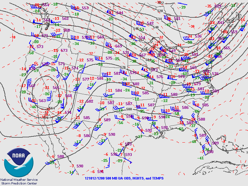
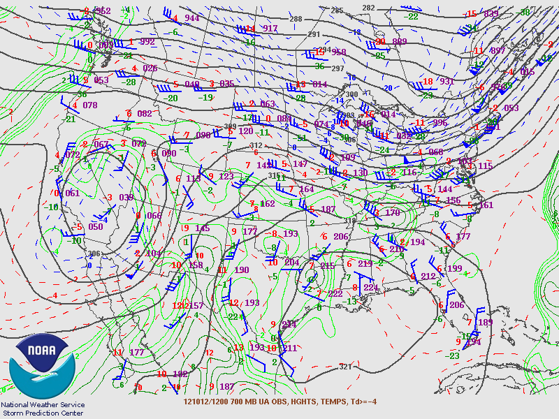

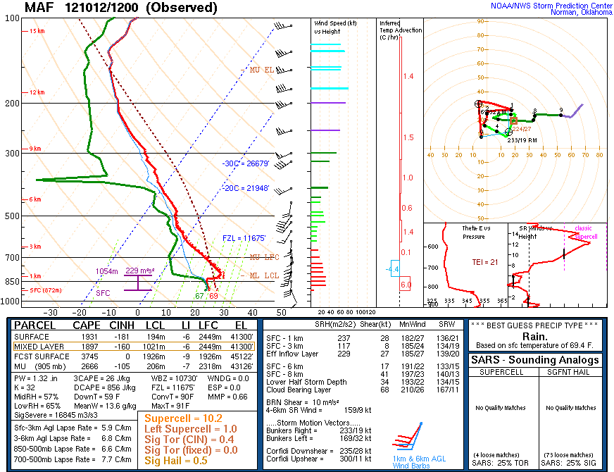
The 12Z sounding from Odessa, which was just south of the warm front at the time, showed a stout cap and not so good shear profiles due to the upper air support still being on the Arizona/New Mexico state line. Instability further north where the better dynamics were progged was the real question mark of the day. Most people were anticipating the best storms to go up within 50 miles of the warm front where the best shear would be.
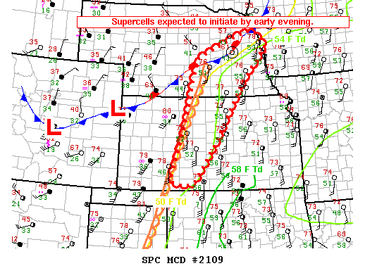
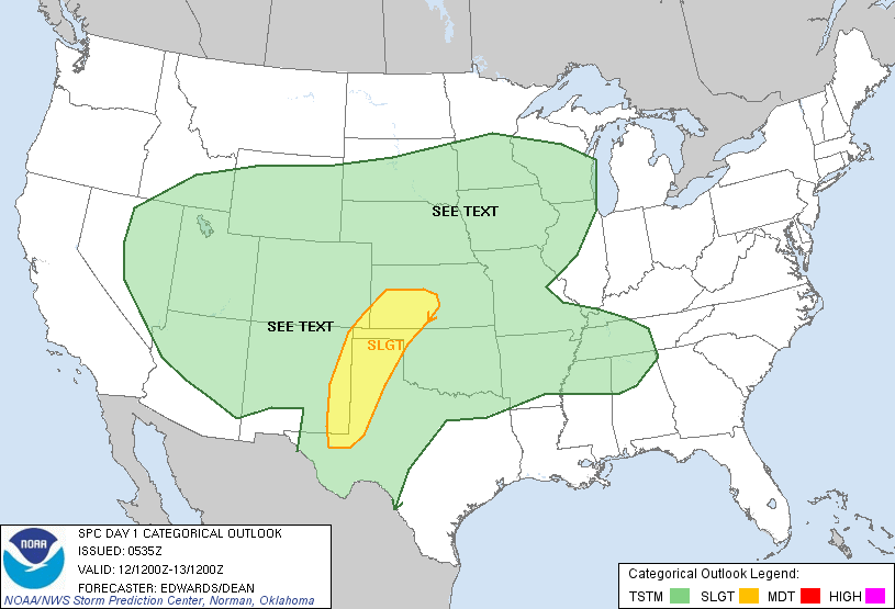
The SPC went with a broad slight risk across the western Texas panhandle and eastern New Mexico with a 5% tornado risk over the NW panhandle and parts of eastern New Mexico.
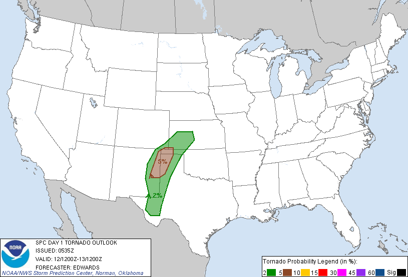
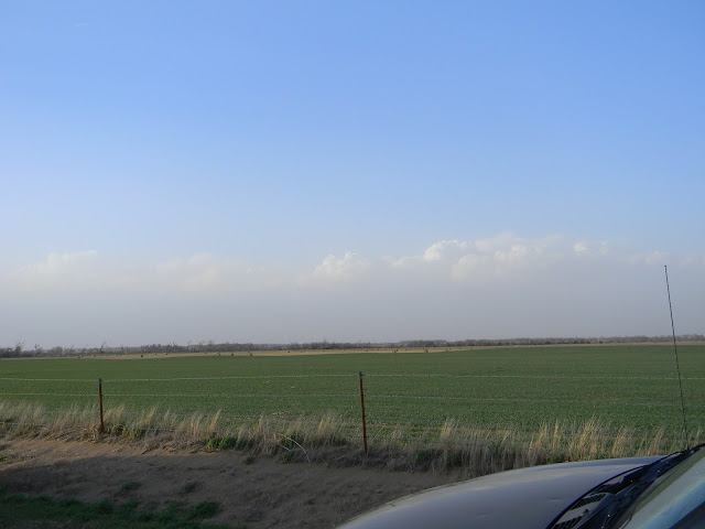
We made excellent time and made it to Amarillo around noon for lunch at Buffalo Wild Wings. At this time the warm front was still sagging considerably farther south than previously anticipated, somewhere between Plainview and Tulia. We rolled out afterwards and headed for Plainview. We got off at Plainview and joined the chaser convergence at the McDonald's for about an hour. Got to see a whole host of people and enjoyed talking over the day's setup. Small high-based showers kept going up and collapsing in the northern half of the warm sector. The trough's late arrival spelled problems for initiation of sustained convection.
Around 4 we decided to take a jaunt up to Dimmit. Some small showers were forming further to the northwest. But after we decided to move they ended up toppling just like the rest.

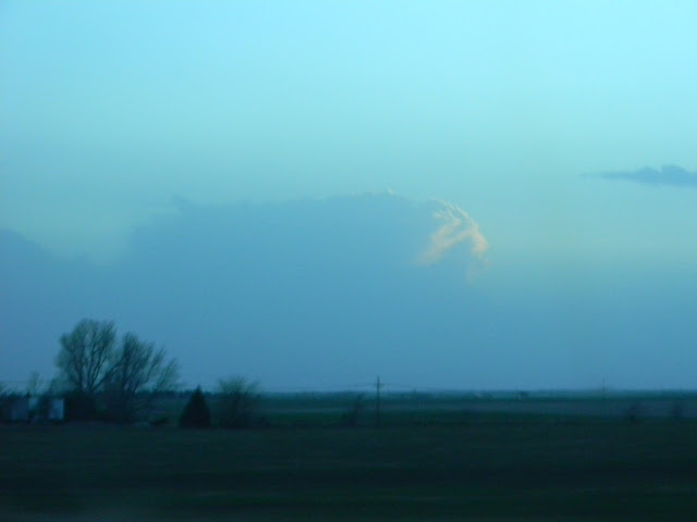
We were beginning to contemplate around 6 either calling it a bust shortly after or going after a supercell that was going absolutely nuts on the nose of the jet streak near Carlsbad, NM. But just as we were about to head back to the interstate surface based storms initiated just outside Lubbock. They took on the look on radar and we quickly piled back into the car and blasted back towards Plainview. The storms looked great from a distance.


After getting to Plainview, we cut south towards Hale Center. After one storm split off of the main complex, it got a brief wall cloud going. Meanwhile the second storm began to turn right and after ingesting a smaller cell started rotating like mad.


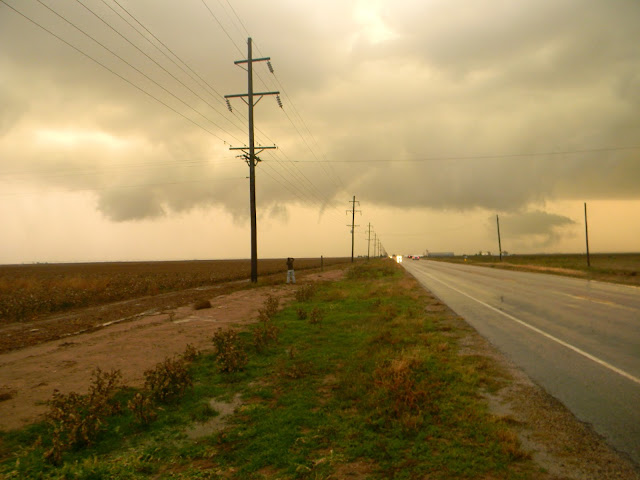
We let the left split pass over and then after cutting down the interstate got off at Hale Center and came through the hook on the backside of the right mover. It had a nice beefy updraft and wall cloud. It also put down a brief, wispy bird fart.


The tornado barely lasted 25 seconds but did mostly condense. We kept sliding forward a bit as the wall cloud cycled again and the rotation picked up. We finally let it cross the road and then re-positioned ourselves.


The old wall cloud/mesocyclone occluded and a new meso formed up further to the northeast and spat out a tiny pencil tornado which would be tornado #3. The old meso had put out a multi-vortex bowl which ended up being #2 but I wasn't able to get a good shot of it since it was on the left side of the car.


The storm rapidly declined after the third tornado. It started to ingest cooler air but was still able to keep some nice structure to it heading into dusk/night. We stopped west of Floydada and took some lightning shots as well as some cool mothership structure shots. Pardon the grainy quality of the photos, my camera tends not to handle low-light situations well.


After that we called the chase and made our way back to Amarillo. Unfortunately the Big Texan was packed and about to close so we headed to the Waffle House and enjoyed some late night waffles. I got the chance to upload some photos and shortly after we made the drive back to Norman. All in all one of the best chase days of 2012 for me.
Chase Stats
Miles Driven: 904
Cost: $50
Tornadoes: 3
Hail: Penny
Winds: 35 mph inflow
James Gustina
Summary: This was a day that had considerable draw early when it began popping up on the models at the end of the week in September. Ended up catching the supercells northeast of Lubbock after nearly conceding a bust due to the late timing of the trough. Three tornadoes and some awesome structure at dusk made this my second favorite day of the year.
The GFS wiffle-waffled on it numerous times during the first week of October but it was apparent about three days out that the Texas Panhandle would be the place to be for a possible early autumn tornado setup. I was having problems finding a ride out but Zach gave me the info of a friend that had seats open. I ended up chasing with Stephen Jones (who I can't thank enough for letting me come along), Jon Stone, and Zach Biggs. We met the morning of around 8 and were on the road after a stop or two to try and get the correct wrench for a roof-mounted HAM antenna.
There was a nice shortwave with attendant cutoff low that was moving from the California coast through the desert early on the 12th.
The 12Z sounding from Odessa, which was just south of the warm front at the time, showed a stout cap and not so good shear profiles due to the upper air support still being on the Arizona/New Mexico state line. Instability further north where the better dynamics were progged was the real question mark of the day. Most people were anticipating the best storms to go up within 50 miles of the warm front where the best shear would be.
The SPC went with a broad slight risk across the western Texas panhandle and eastern New Mexico with a 5% tornado risk over the NW panhandle and parts of eastern New Mexico.
We made excellent time and made it to Amarillo around noon for lunch at Buffalo Wild Wings. At this time the warm front was still sagging considerably farther south than previously anticipated, somewhere between Plainview and Tulia. We rolled out afterwards and headed for Plainview. We got off at Plainview and joined the chaser convergence at the McDonald's for about an hour. Got to see a whole host of people and enjoyed talking over the day's setup. Small high-based showers kept going up and collapsing in the northern half of the warm sector. The trough's late arrival spelled problems for initiation of sustained convection.
Around 4 we decided to take a jaunt up to Dimmit. Some small showers were forming further to the northwest. But after we decided to move they ended up toppling just like the rest.
We were beginning to contemplate around 6 either calling it a bust shortly after or going after a supercell that was going absolutely nuts on the nose of the jet streak near Carlsbad, NM. But just as we were about to head back to the interstate surface based storms initiated just outside Lubbock. They took on the look on radar and we quickly piled back into the car and blasted back towards Plainview. The storms looked great from a distance.


After getting to Plainview, we cut south towards Hale Center. After one storm split off of the main complex, it got a brief wall cloud going. Meanwhile the second storm began to turn right and after ingesting a smaller cell started rotating like mad.


We let the left split pass over and then after cutting down the interstate got off at Hale Center and came through the hook on the backside of the right mover. It had a nice beefy updraft and wall cloud. It also put down a brief, wispy bird fart.


The old wall cloud/mesocyclone occluded and a new meso formed up further to the northeast and spat out a tiny pencil tornado which would be tornado #3. The old meso had put out a multi-vortex bowl which ended up being #2 but I wasn't able to get a good shot of it since it was on the left side of the car.


The storm rapidly declined after the third tornado. It started to ingest cooler air but was still able to keep some nice structure to it heading into dusk/night. We stopped west of Floydada and took some lightning shots as well as some cool mothership structure shots. Pardon the grainy quality of the photos, my camera tends not to handle low-light situations well.


After that we called the chase and made our way back to Amarillo. Unfortunately the Big Texan was packed and about to close so we headed to the Waffle House and enjoyed some late night waffles. I got the chance to upload some photos and shortly after we made the drive back to Norman. All in all one of the best chase days of 2012 for me.
Chase Stats
Miles Driven: 904
Cost: $50
Tornadoes: 3
Hail: Penny
Winds: 35 mph inflow
Wednesday, January 16, 2013
June 29 2012 Chase Log
June 29 2012
James Gustina
Summary: My only chase during the month of June for the first time in my entire chasing "career". On a day that went on to produce a derecho that traversed four states, we got totally skunked. Ended up dawdling in the initial convection so when things sped up we got caught in the line and then Indianapolis traffic as the derecho formed up heading into Ohio.
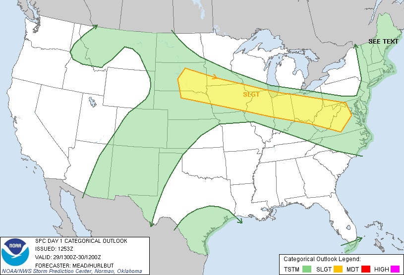
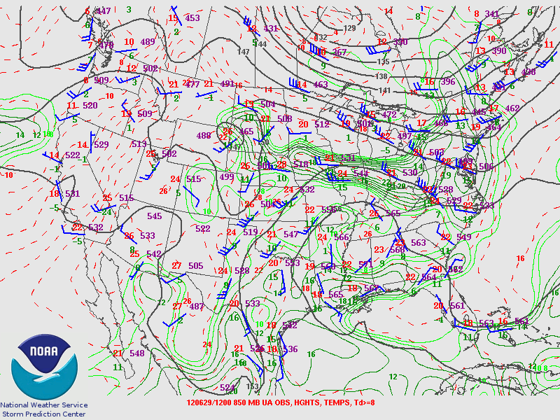
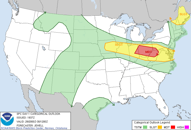
June 29th was one of the first days in June that looked chaseable in the area. Originally it looked like Illinois would be where most of the action would happen but the target slowly shifted more eastward with each model run. Finally on the morning of the 29th it was looking like a typical summer high-instability NW flow event. The SPC had put up a broad slight risk extending from South Dakota all the way to Virginia. The general consensus was that there would be one large QLCS that would form in Indiana during the late afternoon and propagate quickly southeast. There was a "Ring of Fire" upper air pattern with the high sitting squarely over Georgia and Tennessee. Uniform wind profiles took away any substantial tornado threat for the day but the speed shear coupled with high MLCAPE values on the 12Z ILN sounding gave it a good shot for an intense line/LEWP.


We got out of Cincinnati around 11 and made it to our initial target of Delphi, Indiana around 2 and awaited initiation. Around and hour later storms finally started firing off. We hopped on two of the initial little multicells and watched them form up and begin to move southeast.


We sat and watched for about 20 minutes before we decided to go exploring into the core. That was the first big mistake of the chase.


We let the core of the trailing cell pass over and got some small hail out of it. We also saw a muddled whale's mouth along with some shifting winds.


After that we tried to get ahead again because the line was beginning to form up. Unfortunately we were never able to get out ahead again after that. The road network of central Indiana is not a nice grid like the road networks out west, which further hindered any attempt to get back out in front again. Right before we hit the loop around Indianapolis we noted a distant roll cloud but the lead edge of what had turned into a derecho was already heading into central Ohio.


We called the chase when we rounded Indianapolis. The derecho did minimal damage in southern Ohio where the line was more broken but further north caused power outages across most of central Ohio through West Virginia into Maryland. Even though we caught the storms, I still chalk up this day as a bust because even though we caught storms we missed the derecho and didn't really see much of anything worth noting to make this day memorable.
Chase Stats
Miles Driven: 384
Cost: $40
Tornadoes: 0
Hail: Penny/Nickel
James Gustina
Summary: My only chase during the month of June for the first time in my entire chasing "career". On a day that went on to produce a derecho that traversed four states, we got totally skunked. Ended up dawdling in the initial convection so when things sped up we got caught in the line and then Indianapolis traffic as the derecho formed up heading into Ohio.
June 29th was one of the first days in June that looked chaseable in the area. Originally it looked like Illinois would be where most of the action would happen but the target slowly shifted more eastward with each model run. Finally on the morning of the 29th it was looking like a typical summer high-instability NW flow event. The SPC had put up a broad slight risk extending from South Dakota all the way to Virginia. The general consensus was that there would be one large QLCS that would form in Indiana during the late afternoon and propagate quickly southeast. There was a "Ring of Fire" upper air pattern with the high sitting squarely over Georgia and Tennessee. Uniform wind profiles took away any substantial tornado threat for the day but the speed shear coupled with high MLCAPE values on the 12Z ILN sounding gave it a good shot for an intense line/LEWP.
We got out of Cincinnati around 11 and made it to our initial target of Delphi, Indiana around 2 and awaited initiation. Around and hour later storms finally started firing off. We hopped on two of the initial little multicells and watched them form up and begin to move southeast.
We sat and watched for about 20 minutes before we decided to go exploring into the core. That was the first big mistake of the chase.


After that we tried to get ahead again because the line was beginning to form up. Unfortunately we were never able to get out ahead again after that. The road network of central Indiana is not a nice grid like the road networks out west, which further hindered any attempt to get back out in front again. Right before we hit the loop around Indianapolis we noted a distant roll cloud but the lead edge of what had turned into a derecho was already heading into central Ohio.

We called the chase when we rounded Indianapolis. The derecho did minimal damage in southern Ohio where the line was more broken but further north caused power outages across most of central Ohio through West Virginia into Maryland. Even though we caught the storms, I still chalk up this day as a bust because even though we caught storms we missed the derecho and didn't really see much of anything worth noting to make this day memorable.
Chase Stats
Miles Driven: 384
Cost: $40
Tornadoes: 0
Hail: Penny/Nickel
Subscribe to:
Posts (Atom)