We didn't make the decision to chase until 4:15 and were out of Norman and our way for Blackwell to start. The sfc cyclone was sitting around Medford with a semi-sharp dryline and an OFB intersecting it just across the state line in KS. The 17Z sounding from Lamont was impressive, albeit with a large inversion at 700 mb. The wind profiles looked extremely favorable for at least supercells and with dewpoints kissing the lower-70s it began to seem as if LCLs wouldn't be too big of an issue. The SPC went with a SLGT across N OK with a 2% tor risk.


We watched on our way up as the first few attempts failed after going up on the northern side of boundary but by the time we hit Tonkawa full-blown CI was occurring. We decided against going after another storm that had just exploded farther west near Fairview on the dryline for the now strengthening supercell riding the OFB and undergoing a cell merger. As we closed in across the state line we got a view of the storm's base. From there, the chase only went up.

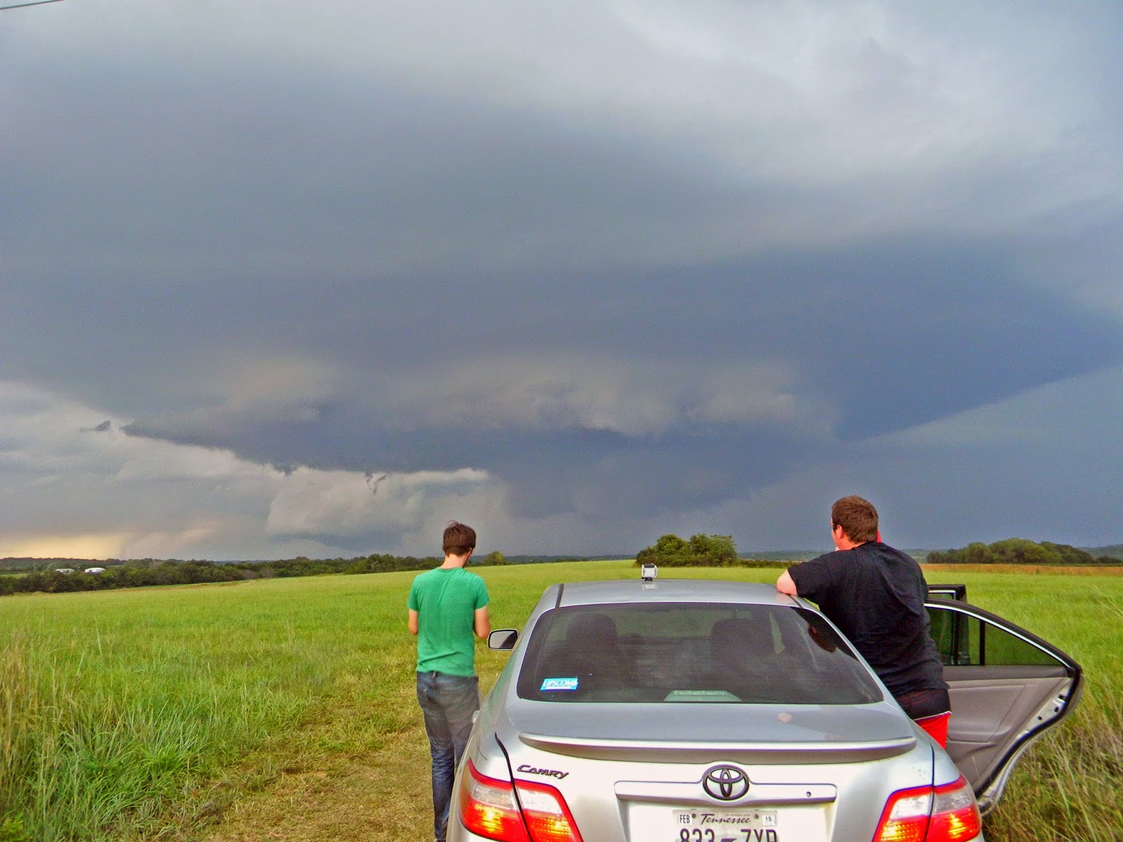
We were busting it east on US 166 and the storm was almost at a standstill making it easy to find a spot to get a good view of the storm's updraft base. We took a road that lead north towards Geuda Springs and sat for a good 15 minutes watching the best supercell that any of us had seen this season.


We noted rapid rising motion/lazy rotation on the right side and after reporting to SN watched the first RFD surge and occlusion. The lowering on the right got some decent spin going but alas nothing ever got close to touching.


After watching the storm spin harmlessly we decided to drop it initially and make a play at the storm that had shot off the dryline earlier. After realizing there was no way we were making that storm by dark (it was closing on 8:30) we stopped at a second severe storm to the west of the Arkansas City supercell. We watched a blood red sun drop beneath the updraft before the storm went completely cool and outflowy.

We made our way back to 35 and stopped at Braum's to grab some food where we learned of our mistake. A large elephant trunk had gone meandering SE near Cedar Vale, KS just before dark on the cycle immediately after we left the storm. Not the best way to end a chase, but it certainly didn't take anything away from the awesomeness we had seen before.
On our way back to Norman, we made a 10 minute stop to photograph lightning just east of Mulhall and got some great crawler action. A great chase day for this late in the season and an unexpected one at that. Here's hoping for more October greatness next month.


Chase Stats
Tornadoes: 0
Largest Hail: None
Highest Winds: 25 mph (inflow)
Miles Driven: 328.5
Cost: $27
No comments:
Post a Comment