Summary
A frustrating day that began with us behind from the getgo. After rushing north on I-35 and beginning to cut east to keep up with a fast moving storm that was slowly taken on supercell characteristics, we were forced to give up the chase as it entered the road dead zone of Osage County. Storms would go tornadic an hour or so later in the Tulsa areas, with a particularly strong tornado near Sand Springs.
This day initially appeared earlier in the week as a possibly potent day in central/east Central Oklahoma, with a more obvious tornado threat in the Arklatex region. By the day of a 1.5-2 km deep moist layer had overspread much of Oklahoma and Texas ahead of a dryline. The biggest issue appeared to be wind profiles providing an unfavorable environment for low-level mesocyclone maintenance owing to the poor timing and entrance angle of the trough. However, by 19Z, a weak cap had been fully eroded and CI was underway across Oklahoma and Texas.
After rolling out of Norman, we continued north on I-35 for roughly an hour until we reached Perry. Storms were already trucking along and about to pass the I-35 corridor completely. We initially latched onto a storm moving rapidly ENE as it neared Perry. We attempted to keep up for roughly 45 minutes but ended up getting left in the dust as it entered the no-man's land of Osage County where spotty roads would make it harder to keep up with the fast storm motions.
At the same time, other storms had not appeared to be getting their acts together (although the initial stages of the Sand Springs supercell were beginning on I-44) and we decided to pack it in and head back to Norman as there'd be no way we'd catch up. By the time we got back, a monstrous supercell was easily visible as it was producing the Sand Springs EF3. I managed to get my only decent picture of the day from my apartment complex's parking lot.
This day left a lot to be desired and portended the absolutely atrocious April to come but it certainly was nice to see the return of skies like this to the Great Plains.
Chase Stats
Miles Driven: 188
Cost: $5
Tornadoes: 0
Hail: None
Winds: ~30 mph
Friday, April 14, 2017
March 7 2016 Chase Log
Summary
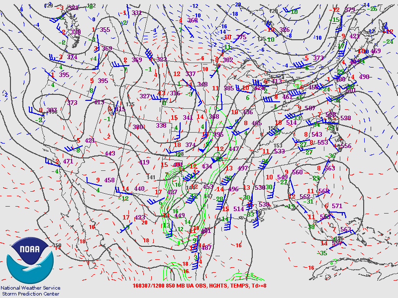
The first chase of the year on a low-end slight risk in southwestern Oklahoma. Initially moved out of Norman for far Elk City but a surging dryline stopped us from going west of Clinton, just west of a persistent cloud deck. Surprisingly decent moisture and mediocre instability failed to combine for anything meaningful, as the dryline began to slowly mix out and retreated well before sunset with little to no cumulus ever getting going ahead of it.
This day ended up being the first shot at discrete dryline storms on the Southern Plains. We initially moved towards Clinton in the early afternoon with the intent to set up along the northern end of a dryline bulge that began to take shape just west of Mangum. After reaching Clinton, we decided to move south on US 183 to Cordell where some agitated Cu was beginning to take shape just west of a persistent cloud deck along the dryline.
Unfortunately for us, as we set up west of Cordell the Cu began to rapidly evaporate in the face of a persistent inversion and weak forcing. Roughly two hours before sunset, the dryline began to retreat, essentially signaling the end of any initiation potential. We made the short drive back to Norman, none the worse for wear.
Chase Stats
Miles Driven: 214
Cost: $10
Tornadoes: 0
Hail: None
Winds: None
Subscribe to:
Comments (Atom)


