James Gustina
Summary: Frustrating yet fun chase day in southwest Kansas. Only notable storms went up right along the warm front just south of the I-70 corridor with the dryline fizzing out. Incredibly photogenic supercell near Great Bend that made up for the day.
The models didn't pick up on this day fully until about four days out. A very weak disturbance was progged in front of the positively-tilted trough from hell coming in from the Pacific. The finer details on the SREF and NAM indicated that a dryline would set up across western Oklahoma and Kansas with the triple point just north of DDC. Rapid moisture return with mid-60 dews were progged with significant MLCAPE values (2500+) for the time of year. The SPC tossed a SLGT risk across most of southern Kansas just along and south of the warm front. The low-level shear looked very promising closer to the dryline but it was also a question of capping and to a degree, forcing, on the dryline further south towards Medicine Lodge.


I ended up chasing this day with Zach Elliot and Brady Kendrick. We got a late start out of Norman around 1 PM but still made good time to our initial target of Alva. We took a slight detour to Waynoka (where the best redneck fair I had ever seen was in progress) before deciding to head north along the dryline in Kansas to get away from the cloud cover that was over much of NW Oklahoma and limiting the thermodynamic environment. The cloud cover was extremely disconcerting, especially with a much more well defined CU field in west-central Kansas.

We went north to Hardtner and sat just west of town for about thirty minutes debating whether or not to bail on the southern play and continue further north towards the warm front along the dryline. We continued north on US 281 through Medicine Lodge and into Pratt. Towers were forming and toppling continuously around us on the dryline near Pratt. Between all the orphan anvils and turkey towers, we couldn't get a clear view of the show that was beginning to take shape further north. When the first severe thunderstorm warning came in on a cell that looked distinctly supercellular, we decided against going after it. The storm was then near LaCrosse and looked to be on the wrong side of the front. We still held out hope for the dryline.

After about another 45 minutes, we decided the dryline wasn't going to do it. We began to head towards Greensburg and about halfway there got a view of the now atomic updraft of the storm to the north. We quickly doubled back to Pratt and Zach put the pedal to floor blasting north on US 283 to Great Bend. The storm's updraft tower definitely had the "look" to it at that point.
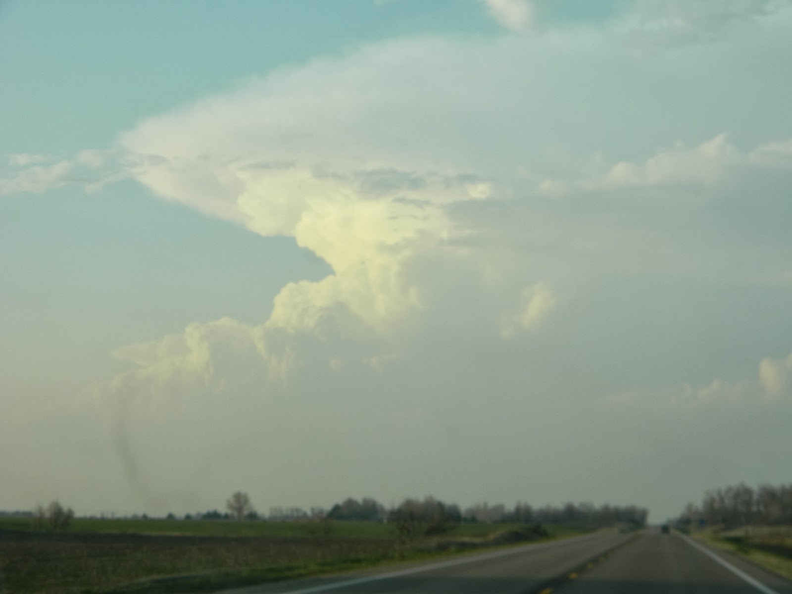
As we were moving north near Saint John, Zach got a photo of what looked to be a perfect classic supercell with a monstrous beaver tail. That was the storm we were still a good 30 miles off of. We continued blazing north through Saint John and just as we entered Barton county south of Great Bend we got a stunning view of the storm. This is still one of my favorite shots of the season.


All credit goes to Brady for these, he was in the passenger seat and with a death grip on my camera got it out the window to get some great shots of this. We continued north into Great Bend and then turned east on US 56 towards Lyons, with the intent to get out ahead of the hail (which was in the range of an inch at that time if I remember correctly) and south again to get more shots with the sunset. We could see the core off to our left and thankfully beat it to a southbound option just past Ellinwood. We ended up getting some cool photos of the elongated base and I actually managed to grab a bolt out of the anvil with my not-really-a-DSLR camera.


After about ten more minutes, we plotted our route back to Norman, which required taking some farm roads to get to Hutchinson and US 50 to get to I-35. Thankfully we got back to Norman in great time around 1 AM and were able to enjoy the first real success of the season.
Chase Stats
Miles Driven: 576
Cost: $20
Tornadoes: 0
Hail: None encountered
Wind: N/A
No comments:
Post a Comment