James Gustina
Summary: Chased with Jon Stone on a marginal early spring setup across southern Oklahoma and northern Texas. Caught some briefly supercellular structure with a rotating wall cloud near Payne, Oklahoma followed by a multi-tiered shelf cloud near Gainesville, Texas on an approaching multicellular line and finally some weakly supercellular storms east of Decatur, Texas. Despite the great shear environment in place over the area, storms went up in one big mess and ended up not being able to get the low-level mesocyclone organization necessary for tornadogenesis. Still, a great second chase for the season and it feels good to have gotten some severe storms for the first time since October 12.
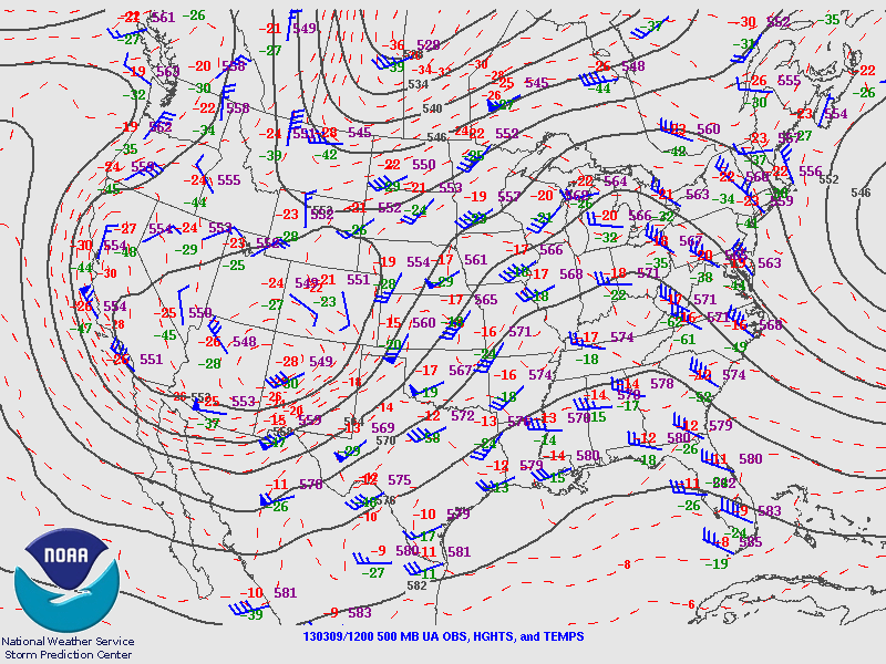
This day popped up on the long-range GFS in the final week of February with a very different picture than the one that emerged the day of. On the morning of the 9th, a very deep longwave with a slight positive tilt was rolling out of the Rockies with an attendant jet streak rounding the base of the trough in the early morning. The initial convection that went in up in western Oklahoma along the dryline in response to that forcing would turn out to be the only storms of the day.

I headed out with Jon Stone around noon just as the first storms went up to the west near Altus along the dryline. From the getgo the storms were linear and outflow-ish.


We dropped south on 35 to about Paoli before cutting west on SR 19 to meet a storm that had just gone severe warned in the main line. After getting through Maysville, we cut south and then east again to get a view as the storm went northeast of us. It actually got a pretty good base going with what looked like rising motion on a lowering further up the rear-flank gust front.


We originally intended to go after it but the storm already had a decent head start and was halfway to Norman before we got back to I-35. We then decided to head south to a second line of storms that was making it's way across northern Texas. After making it across the Red River, we stopped at a rest area near Gainesville to survey a storm we had just passed through. It had a pretty awesome multi-tiered shelf with it that made for some ok photos.


After that little spectacle, we continued down the line of storms before cutting over at Valley View to view one last severe thunderstorm embedded in the line. We stopped just outside of Era and viewed a very grungy, piece of crap "shelf" if you can even call it that before calling it a day.


We then continued back north through Gainesville, with Jon trying to get some footage of the core hitting us. Afterwards, we took a brief stop to get some dinner before rolling back up to Norman.
Chase Stats
Miles Driven: 183
Cost: $35
Tornadoes: 0
Hail: none
Wind: 45 mph (estimated)
No comments:
Post a Comment