James Gustina
Summary: My only chase during the month of June for the first time in my entire chasing "career". On a day that went on to produce a derecho that traversed four states, we got totally skunked. Ended up dawdling in the initial convection so when things sped up we got caught in the line and then Indianapolis traffic as the derecho formed up heading into Ohio.
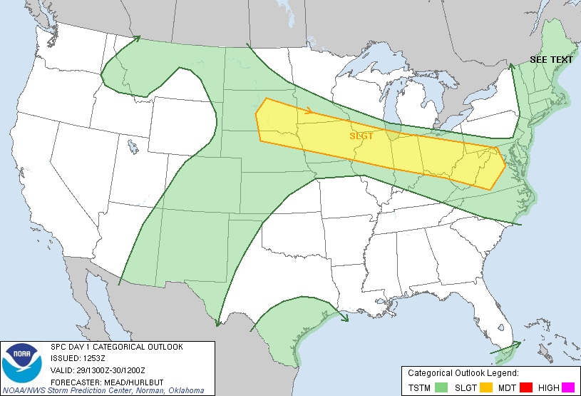
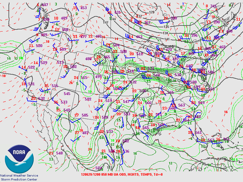
June 29th was one of the first days in June that looked chaseable in the area. Originally it looked like Illinois would be where most of the action would happen but the target slowly shifted more eastward with each model run. Finally on the morning of the 29th it was looking like a typical summer high-instability NW flow event. The SPC had put up a broad slight risk extending from South Dakota all the way to Virginia. The general consensus was that there would be one large QLCS that would form in Indiana during the late afternoon and propagate quickly southeast. There was a "Ring of Fire" upper air pattern with the high sitting squarely over Georgia and Tennessee. Uniform wind profiles took away any substantial tornado threat for the day but the speed shear coupled with high MLCAPE values on the 12Z ILN sounding gave it a good shot for an intense line/LEWP.


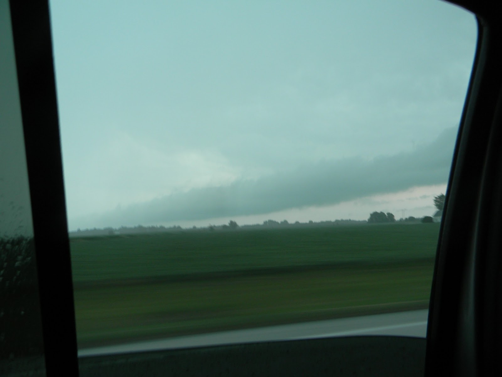
We got out of Cincinnati around 11 and made it to our initial target of Delphi, Indiana around 2 and awaited initiation. Around and hour later storms finally started firing off. We hopped on two of the initial little multicells and watched them form up and begin to move southeast.


We sat and watched for about 20 minutes before we decided to go exploring into the core. That was the first big mistake of the chase.


After that we tried to get ahead again because the line was beginning to form up. Unfortunately we were never able to get out ahead again after that. The road network of central Indiana is not a nice grid like the road networks out west, which further hindered any attempt to get back out in front again. Right before we hit the loop around Indianapolis we noted a distant roll cloud but the lead edge of what had turned into a derecho was already heading into central Ohio.
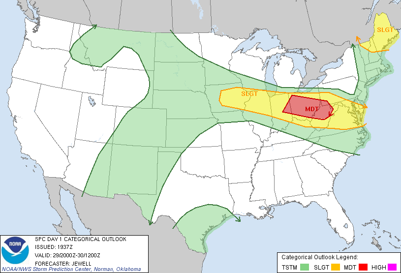

We called the chase when we rounded Indianapolis. The derecho did minimal damage in southern Ohio where the line was more broken but further north caused power outages across most of central Ohio through West Virginia into Maryland. Even though we caught the storms, I still chalk up this day as a bust because even though we caught storms we missed the derecho and didn't really see much of anything worth noting to make this day memorable.
Chase Stats
Miles Driven: 384
Cost: $40
Tornadoes: 0
Hail: Penny/Nickel
No comments:
Post a Comment